Friday, December 25, 2009

Scio Covered Bridges 200k Permanent

Last November, I completed my 23rd consecutive monthly 200k (or greater) randonneuring bike ride. But I hadn’t figured out what to do in December…until…Don Boothby of Seattle announced his intention to ride the Scio Covered Bridges permanent on Saturday the 5th. “Cool,” I thought, as Saturdays generally work much better for me than Sundays. Plus, Don chose the route with which I started all this R-12 business (with Cecil and Lynne back in January ’08).

The weather turned out to be a bit beyond “cool” on that blustery Saturday morning. There were six riders who expressed interest in participating, but predictions of icy temperatures convinced two riders not to make the trip down from Washington. That left Don, John Vincent, Sam Huffman and me at the Starbucks in Wilsonville for a 7:30 AM start. But because the sun had yet to melt the layer of early morning frost, Don elected to delay the start one hour. Even then, John thought better of embarking on the ride, and decided to drive himself and his recumbent directly back to Olympia.

That left Don Boothby, Sam Huffman, and me. After 8:30, the three of us rolled out to I-5, and gingerly rode the interstate bridge that crosses the Willamette. The Eastward decent down Miley Road looked problematic, enough so that Don and Sam elected to ride back to the Starbucks. I, on the other hand, continued on slowly, but was concentrating so hard on road surfaces that I missed the right turn to Airport Road (hence a bonus mile or two).

Once on Airport Road, things improved significantly. Roadside gutters still contained intermittent patches of ice, but the roads for the most part became rideable. The sun even made a brief appearance, but then went away again until the afternoon.

In Silverton, I visited briefly with tango friend and ex-landlady Ann Shams. I’m glad that stop was brief, because low and behold who shows up at Water and Main as I’m exiting the town…none other than “ready to roll” Don Boothby!…on his 20-year-old Raleigh mountain bike with moustache handlebars and studded tires! He mentioned back in Wilsonville that he had studded tires, but I didn’t realize they were mounted on a backup bike is his pickup.

With company for the rest of the ride, my pace picked up (although Don’s probably decreased some). I wasn’t confident of being able to pedal up the second (very steep) grade on Cole School Road, but barely managed. From there, we continued to the Schimanek Covered Bridge, where I dropped my old Nikon CoolPix. My picture of Don exiting the bridge is the very last one taken with this camera (as the lens housing is irrepably bent). From the Schimanek Bridge, we rode on to Scio, the Huffman Covered Bridge, Crabtree, and the Gilkey Covered Bridge.

Before reaching Jefferson, the route heads North towards Parish Gap Road. Oddly, I didn’t remember Parish Gap from this ride 23 months ago, but I did remember it from the Alsea Falls 400k last August. I have to admit, it’s a little easier 70 miles into a ride rather than 170 miles.

Don and I wound our way to Salem by dusk, took his picture in front of the state capital (where he was once inducted into the Marines), stopped at the local Safeway for some fuel, then continued on a nocturnal 40-mile journey back to Wilsonville. The bike paths exiting Salem were pleasantly clever. But the most remarkable part of this segment was how in-the-middle-of-nowhere we felt, despite the fact we were roughly paralleling I-5 for much of the way.

R-24 in the books

Don was anxious to get checked in, so we used the Plaid Pantry is Wilsonville for the final contrôle. After that, we finally warmed up at Starbucks.

I’m glad Don scheduled this permanent, and ultimately rode it, thereby providing good company, and helping me ride a bit faster than I otherwise would have. Plus, I got my second R-12 out of the way just before Oregon was deluged with a week of colder, freezing weather.

My pictures are here on Flickr.
Don's account of this ride is blogged here.

Monday, November 30, 2009

thanksgiving day fixie ride (with food)

David Auker has been hosting a Thanksgiving Day fixed-gear bicycle ride for as long as I’ve been cycling (which isn’t that long). And the last three Thanksgivings, he and his wife Sarah have served a pre-ride breakfast consisting of huevos rancheros, potatoes, cinnamon rolls, fruit, and of course, coffee.

fixie fuel
Originally uploaded by tangobiker

Attendance was down a little this year, perhaps because of the gray wetness that persisted all day. Nevertheless, I knew some of riders who showed up, including Bryan Curry and John Forbes. (David’s a veteran racer, and therefore knows a lot of guys I don’t.)

The ride took off from the Auker home in the hills of SW Portland, and immediately headed up to the Fairmount loop. After 1 ½ laps, we rode Humphrey Blvd. over to Sylvan Hill. Both Bryan and John had gone their own ways before this point. I said goodbye to Dave at the Scholls Ferry – Skyline intersection, and after warming up a bit at the Sylvan Hill Starbucks, continued on Skyline clear over to Newberry Road (past Germantown). Newberry probably wasn’t the best road to descend to Hwy 30 on a fixie in the rain (constant grittiness between my brake pads and rims), but I made it, and then continued to Sauvie Island.

end of the road
Originally uploaded by tangobiker

On the island, I rode “lower” Sauvie Island Road, which ended at a protected Wildlife Area. By this time, I knew I was far enough along to reach 100k by the time I got home.

I stopped at my friend Amy’s parent’s home in St. John for some delicious Thanksgiving leftovers and some fun games before finishing the ride. And the distance once I arrived home was 66.6 miles (or 107 km). Must say, I was a bit sore after this many miles of no coasting on a single-speed (the first half in the hills). But it was good to get in my annual Thanksgiving workout … and dine so well in the process.

All eight pictures from the day are here on Flickr.

Sunday, November 29, 2009

Nehalem River 200k Permanent

(Another delayed report)

For the 11th installment of my 2nd R-12, I chose to ride Marcello Napolitano’s Nehalem River 200k permanent (from Vernonia to Astoria and back). Initially, it was Ray Ogilve who scheduled this ride for the 14th of November, but he backed out due to a brush with the H1N1 virus.

That left David Kamp, Ken Mattina, and me. None of us got to the start in Vernonia early on that cold Saturday morning (except maybe Ken), so our 7:00 rollout time got delayed about a half hour. The temperature as we departed Vernonia was a few degrees below freezing.

The cue sheet for Marcello’s Nehalem River 200k is the shortest I’ve ever seen. It’s actually memorizable, as there are only a couple of turns, a couple of highways (numbers 47 and 202), and one mid-route contrôle (at Birkenfield, each way) for the entire 200 kilometers.


10 miles till astoria
Originally uploaded by tangobiker
I hadn’t met David before, but enjoyed chatting with him about his experience at PBP in 2007. Clearly a seasoned rider, he made much quicker work of the Birkenfield contrôle than me. (I couldn’t turn down real hot chocolate in a ceramic cup.) I would see David once more during the day, and that was a few miles outside of Astoria as we waved while passing in opposite directions.

Ken fell back a bit early, about half way to Birkenfield, so I would see him only once more during the ride as well. Like with David, it was again a few miles outside Astoria, only this time after my turnaround.

While the weather threatened to rain during much of the ride, it (for the most part) stayed dry. I did end up putting booties on at the first Birkenfield contrôle, but that was more for warmth than dryness.


helmeted colonel ...
Originally uploaded by tangobiker
I “did lunch” with Colonel Sanders at the KFC in Astoria (near where Astoria-Megler Bridge crosses the mouth of the Columbia River over to Washington), and then headed back over the Coastal Range. It’s 40 miles between Astoria and Birkenfield, but at times during the return it seemed longer.

The sun set while I snacked in Birkenfield, but my now-trusty Edelux lit up the last 20 miles to Vernonia just fine. And while my official time was 11 hours and 50 minutes, my on-the-bike time was barely under 10 hours. Guess I needed those sit down breaks in Birkenfield and Astoria.

Complements to Marcello for putting together this nifty 200k “permanent” (ride).

Photos at Flickr.com

Saturday, October 31, 2009

Bikenfest 2009 200k

It took me forever to start chronicling the Bikenfest 2009 200km ride … but here it is:

I always look forward and enjoy John Kramer’s brevets, and this one was no different. New starting place. New (to me) roads. Good scenery. Challenging yet doable route. And now another notch on my 2nd R-12 belt.

Alan Woods graciously offered to drive me to the start in Hood River, and collected my bike and me in the wee pre-dawn hours of Saturday (October 3rd). My friend Amy had already offered to meet me at the finish that evening and take me back to Portland, so it was cool to get a ride to the start and not worry about Alan having to wait around at the finish. (His 200k time is almost 2 hours less than mine.)

Alan had also ridden the Mt. Adams SxSW 200k a few months earlier, where I volunteered at one of the secret contrôles. Interestingly, he remembered two things from that contrôle: 1) the funky old motorcycle I had ridden out there that day, and 2) Amy’s colorful flowing scarf. It’s funny the things that linger in our memories.


rain in the distance
Originally uploaded by tangobiker
The Bikenfest brevet started eastwards from Hood River and took us on the scenic bikeway that heads towards Mosier. From there, we rode over Sevenmile Hill to The Dalles. From that summit, one could see a storm a’brewing in the vicinity to which we were heading.

For the first half of the ride, I felt sluggish, with none of the alacrity I had felt a week earlier on the 1st 2/3 of the Barlow Trail 300k. It felt like my tires were under-inflated. But in actuality, it probably had more to do with the strong ale I enjoyed at Madison’s Bar and Grill the night before. The end result, though, was that I didn’t see any other riders for most of the first half of the ride.

It took a while to grock how to get out of Hood River, because my mind’s eye was convinced that the Maryhill portion of the route (on the Washington side of the Columbia River) was gonna precede the rural farmlandy Oregon portion. (I tend not to do much research beforehand on these kinds of brevets.) But once I figured out that I needed to cross under the US 197 overpass, I was good to go … right into that nice little rain storm I had seen a’brewing about an hour earlier.


josh and alan
Originally uploaded by tangobiker
The “towns” in this area of Oregon amount to little more than intersections with a few signs and buildings scattered around. Such was the case at the info contrôle “in” Fairbanks. Between Fairbanks (OR, not AK) and the next contrôle (which was literally just a signpost at an intersection) I momentarily wished my booties had made the trip. But the rainstorm passed by the time I returned to The Dalles, as did the need for protective rain gear.


peg and lesli
Originally uploaded by tangobiker
My sluggishness abated a bit during the second half of the brevet, which was basically an out-and-back on WA Hwy 14 to the Maryhill Museum. By this time, I caught up with John Hughart, as well as the trio of Lesli Larson, Peg Winczewski, and Tom Bonamici (who had all made a brief stop in The Dalles). We all leapfrogged to Maryhill, where Paul Whitney, John Kramer, and some colorful peacocks were “manning” the contrôle. [Thank you Paul for the double-bagged black tea!]

The route passed through The Dalles for a third time on the return portion of the ride. It was here that I made a caffeine stop at the Union 76 Mini Mart. The cashier there was quite a character, and was memorably impressed by Cecil’s Sweetpea. (She must have passed through about ½ hour earlier.) He couldn’t understand why none of our bike had kickstands! “You’ve got bags, lights, beautiful fenders … but no kickstand?!”

I ascended up to scenic Rowena Crest (overlooking the Columbia) alone, but shortly afterwards joined up with Peg, Tom, and Lesli for the final 14 miles. After Mosier, Peg’s and Tom’s headlights failed, so we rode as a quartet along the darkening scenic byway and on to Hood River.

‘Twas an enjoyable ride that featured a lot of Oregon territory I had never seen before. Thank you John!

Wednesday, September 30, 2009

Barlow Trail 300k


takin' off
Originally uploaded by tangobiker
Prior to Michael Wolfe’s excellent and challenging 189-miler (last Saturday, Sep 26th), I had ridden five other 300k brevets. Three of them were the ’07, ’08, and ’09 versions of the Three Capes 300k brevet that heads out of Forest Grove to the Oregon coast and back every April. The other two were in August ’08 … Mr. Wolfe’s Detroit Lake 300k, and the SIR Tumwater-Mt. St. Helens-Tumwater 300k. Ironically, my fastest 300k was my very first (Three Capes in April ’07). I have never come within an hour of that 16 hr, 41 min time since then. In fact, most of my times have been in the 18 to 19 hour range. And the SIR brevet took me a Cyclos Escargot qualifying time of 19 hrs and 42 minutes.

But for the Barlow Trail brevet, I was feeling primed and ready to do relatively well. My lighter LeMond Buenos Aires was now set up for rando use, my generator front wheel now moved to that bike, a bright new Edelux light mounted to its front skewer, and my old small Caradice tailpack mounted behind the seat (rather than the rack and pannier set up I had been using on my Mountain Cycle Stumptown).

why we rando
Originally uploaded by tangobiker
The Stumptown (an aluminum ‘cross bike with 15,000+ miles) had been the weapon of choice for most of my randonneuring activities (and all the rides 300k and over). That bike, though, is now stripped (for the first time in two years), and ready for the ’09 cyclocross season.

I managed to get to Sandy, Oregon in plenty of time for a punctual 6:00 AM start, and had the novel experience of riding with or leapfrogging a number of other riders for the first 200k or so. Had a nice conversation with RB Buschman on quiet and scenic Faraday Lane (off of OR Hwy 224), and even rode a little with Kramer (who had been handicapped with an early flat) until he flew up NFD 5810 Road towards the Anvil Creek Crossing. I saw quite a bit of Mark Thomas, Vincent Muoneke, and Geoff Swarts (all of whom came down from Seattle) for the first 9-10 hours of the ride, although their style of riding involved longer breaks than what I took. However, once we hit relentlessly steep NFD 48 Road on our return over the Cascades, they were soon out of sight for the remainder of the brevet.

The descent towards Maupin on Oregon Hwy 216 is probably the longest stretch of fast road I have ever experienced.

deschutes river
Originally uploaded by tangobiker
My 1:30 PM arrival time there gave me the illusion of a possible PR for the 300k distance. That would soon fade, though, into the headwinds that paralleled the Deschutes River. And a couple of hours later on NFD 48 Road, the illusion totally vanished. I managed to keep up with RB for much of that ascent. But when daylight faded, so did my energy. I spotted RB 15 minutes during a wardrobe change ‘round dusk, and wouldn’t see him again until my arrival in Sandy.

My body ran outa fuel during that ascent up to Hwy 35 (pdj sandwiches and Ensure all used up), and my left leg cramped up at one point. So when I finally got to Government Camp, I sat down for a proper meal at the Huckleberry Inn (just as Scott Peterson and Kramer were departing). After a bowl of tomato-meat-pasta soup, some funky mocha, and a rather large doughnut, I started my descent towards Sandy. An hour and a half later, I arrived at the finish, where Philippe Andre was performing check-in duties. Scott and RB were still hanging around, so I was able to rehash some of the ride with them. I believe my official finish time was 17:50, which would still be my second best time for a 300k.

Thanks to Michael Wolfe for another excellent route. I was particularly happy that he had us traverse Anvil Creek, as the roads on either side of that ‘cross like obstacle were part of what made the ride memorable.

Photos here on Flickr

Wednesday, September 16, 2009

UGB 200k report


rando xtracycle
Originally uploaded by tangobiker
Without putting much thought into it, I made a note to self to ask Michael Wolfe what UGB stood for. Then about 50 kilometers into the actual 200k ride, somewhere in rural, agricultural Clackamas County (between Boring and Canby) it dawned on me. Urban Growth Boundary. 'Twas a ride than circumnavigated the outskirts of greater Portland.

I like the concept. But the ride's main appeal was how close the start and finish are to where I live. Shoot, I could probably sleepwalk to East end of the Hawthorne Bridge; it’s part of my daily commute, and less than 2k from home.

Actually, I wasn’t so sure I’d be able to do this ride after an inconvenient faceplant on NE Alberta St. 2 ½ days before the ride. But on that Saturday morning (September 5th, the start of the 3-day Labor Day weekend), with a stitched up nose and a puffy upper lip, I managed to meet Ken, Keith, and David at the Burger King (the only establishment dependably open at the end of the Hawthorne Bridge), and then do the ride. Ken Mattina I’ve known from a number of rides, most notably our co-lantern-rouge finish at the Covered Bridges 400k back in May 2007. Keith Thorla I recently met at Kramer’s SxSW Mt. Adams 200k a couple months ago. And David Parsons was new to me, as was his Trek-framed Xtracycle. He was also (I believe) probably the fastest of our quartet.

The weather was drizzly as we headed down and out the Springwater Corridor. By the time we hit the first control (for which I must thank Ken for preventing me… twice … from passing by), David and Keith were already pushing ahead. Ken and I rode together to Boring and Barton Park, and then the hills appeared. Ken rides a fairly loaded-down heavy bike, which to my mind, may not be the hill-friendliest rig around. After a few miles of separating, waiting, separating, waiting, Ken decided to head back to Portland (via Oregon City), while I pushed onwards. Between the hills, rain, and Ken's back and knee rehab, he just wasn’t having a very good time. As it turns out, I made it to the Canby control with only 5 minutes to spare.


willamette river ...
Originally uploaded by tangobiker
The rain stopped after Canby, and the sky lightened up from Champoeg Park on. My favorite part of the ride was the newly paved bike path that hugs the Willamette River through Champoeg Park. I liked it so well that I rode a bonus mile or two before finding the road that heads out of the park, and eventually to Hwy 219 and Newberg.

The next control after Canby was Gaston, meaning the only reason to stop in Newberg was to flip over of the route sheet. After a little foray on less-than-familiar roads, I soon found myself on North Valley Road, famous (in my little world) for its Ribbon Ridge wineries.

I saw David and Keith heading the other way out of Gaston, which meant they were about 20 minutes or so ahead of me. I tried to make quick work of my stop at the Gaston Market, but never did catch up with either of them.


double shot cap
Originally uploaded by tangobiker

Rode mostly familiar roads into Cornelius, towards Helvetia, then over to the 2nd-to-last control at McMennamin’s Rock Creek Tavern. There, I swallowed a double shot cappuccino before heading up Old Cornelius Pass Road, and then further up Skyline Blvd (before it levels out into mild rollers). Initially, I thought I would finish the ride before nightfall, but it got dark before my descent down Thompson Road.

Michael’s route cleverly takes the rider from NW Cornell to NW 30th Ave. via what looks like a driveway that heads back the other way. That in turn runs into Quimby St., then 29th (the left turn navigatible only to pedestrians and cyclists), then Raleigh St, which offers a pleasant way to Naito Parkway. After catching the Westside Esplanade to the Hawthorne Bridge, I finished at 8:40 PM for a Cyclos Escargot-ish total elapsed time 13 hours and 10 minutes. 'Twas also my 21st consecutive month of completing a 200k or longer randonneuring ride.

And then I was home by 9:00 pm! Yeah! Thank you Michael for the close-in UGB permanent!

My photos are here on Flickr.
David Parson's blog report

Friday, August 21, 2009

vineride century

Hadn't done a supported bike ride in a year. In fact, RSVP 2008 (Seattle to Vancouver, BC) was the last time (almost exactly 12 months ago).

As this 100-mile ride on August 15th was supported (and therefore more expensive than what I’m used to), I made a point not to bring anything but the bare essentials. I would not make any convenience store purchases, I’d leave the energy bars, sandwiches, gels and supplements at home, and I’d eat only what was provided at the rest stops. With this strategy, I didn’t mind the $52 registration cost, as the ride was basically a benefit for the Children’s Cancer Association (a group I’m happy to support).


witness tree
Originally uploaded by tangobiker
This was a good ride to do after the previous weekend’s Alsea Falls 400k. It felt easier than most centuries I’ve done (my last one being the Ride Around Clark County [RACC] in May 2008). The Vineride traversed some of the same roads around the Eola Hills portion of last week’s Alsea Falls 400k, and introduced some new-to-me roads as well.

My main disappointment during this century was mechanical in nature. My rear derailleur started going AWOL, popping out of gear(s), not up-shifting, and not moving over to the largest or smallest cogs (quite inconvenient on hilly Eola Hills Road).

But the two highlights were:
  1. Mechanical support in Dayton.
    The mechanic from Lakeside Bicycles diagnosed my shifting problems and replaced my rear derailleur cable, which had both stretched and frayed beyond use. Now here’s a benefit of a supported ride!
  2. Winemaker Felix (of Carlos and Julian Winery in Carlton) looking at my bike and saying/pronouncing “Ah, LeMond Buenos Aires” as only an Argentine can do. This was after I briefly tasted his Pinot Noir, Tempernillo, and Malbec.

The route passed by a lot of familiar (and not so familiar) wineries, including Willakenzie and Patricia Green during the last leg into Newberg. The finish was well stocked with turkey and ham sandwiches, pasta salad, fruit, cookies, and ice cream. A number of riders hung around for a raffle (a bike from Lakeside). It was nice for me to finish while still daylight, and not be totally exhausted.

Pictures are here on Flickr.

Friday, August 14, 2009

basket case completes SR* requirement

an Alsea Falls 400k brevet report

*SR = super randonneur

I’m getting kinda known for my late starts at randonneuring events. (Lord knows I can ill afford them.) But for the Alsea Falls 400k, I was totally on track to arrive ½ hour early. Got some coffee in Newberg ‘round 5:00 AM, approached McMinnville about 5:30, went all the way through town (so I thought), but saw no Best Western, and nothing resembling the address “2035 S Highway 99W.” I made two more passes from the eastern edge of town to the western end of the one-way streets, the first time consulting a gal at McDonalds, and the second time a gal at Dutch Brothers. It never occurred to me, even when viewing Google Maps the night before, that there was anything to McMinnville beyond the one-way streets. But the gal at Dutch Brothers had an iPhone with a map function and let me know I hadn’t gone nearly far enough.

I finally got to the Best Western at 6:10 AM, and even though I had laid everything out and deliberately packed the night before, I discovered my pannier neglected to make the trip. Unplanned lateness plus a missing critical piece of equipment turned me into a less-that-fully-functioning basket case. I couldn’t even unbuckle my bike shoes! Michael and Philippe were patient, the latter loaning me some old leather toe straps to secure my improvised duffle bag to the rear rack. Michael called out my actual departure time as 6:33 when I left.


them thar hills
Originally uploaded by tangobiker
According to Michael, the first part of the ride (up to Bald Mountain) would be the hilly part, and the rest of the ride would be relatively flat. And while the first part of the statement was true, I think Michael defines “hilly” a little differently that some of the rest of us. The initial hilliness started about 10 or so miles into the ride on Meadow Lake Road, and continued to the first contrôle at Bald Mountain Lookout (manned by Philippe and Michael). From there, it was a fun descent towards Willamia.

The roads from Willamia to Sheridan and Ballston were familiar from other brevets, but Broadmead Rd. linking Ballston to Perrydale Rd. was new to me. Perrydale Rd. essentially runs into Dallas, where I stopped at Santaim Cycles for a tire pump, as mine was in the pannier that got left at home. Salesman Dan was quite intrigued with my Stumptown (he seemed to know the guy that designed it for Mountain Cycle), and with my generator light setup. I guess not too many randonneuring types frequent that establishment.

Falls City struck me as a town hard hit by the economy. Or maybe it was already hard hit before the downturn. I dunno. The ladies behind the counter let me know that the previous rider been through about ½ hour earlier. So I wasn’t gaining time on anyone.

What would a Philippe/Michael brevet be without a gravel section? Well, the one between Falls City and Kings Valley Road was fairly tame as gravel roads go … quite hard-packed. ‘Twasn’t necessary to deflate the tires.

Seemed like there was an inordinate amount of roadkill on this ride. Quite a few deer … running the gamut from freshly extinguished to thoroughly decayed skeletons. There were rodents, felines, and even a colorful bird that had met untimely roadside demises. Made me wonder if Polk Country has any sort of clean-up program for deceased roadside animals.


colorful schwinn
Originally uploaded by tangobiker
One of the prettiest roads of the day was the Alsea Highway. It’s funny how “pretty” and “steep” often go hand-in-hand on a ride like this. An unfortunate part of that 16-mile ascent was all the litter along the side of the road (quite noticeable at my slow uphill pace). The main culprits appeared to be consumers of Dutch Brothers Coffee and Corbett Canyon wines. (Corbett’s 1.5 liter bottles have a distinctive shape.) I got to thinking that this is probably a result of a large portion of society that says (from the top down) “it’s okay to do whatever, as long as you’re not caught.”

Shadows got real long riding from Alsea to Alsea Falls, and by the time I descended down to Monroe, it was totally dark. I couldn’t find West Ingram Island Road out of Monroe until after I rode up the down the main drag a few times and then got help from a Dari Mart employee. Then before Harrisburg I failed to see McMullen Lane, even after a local kid in a driveway told me “it’s right up there by the stop sign.” Never saw a stop sign till a mile or so further when I got to Highway 99E. Chalk up another bonus mile or two.


brownsville contrôle
Originally uploaded by tangobiker
It was good to see cheery Keith and Alex signing cards and offering refreshments in Brownsville (a town I’d never been to before). At that contrôle, I topped off my Coke-filled water bottle with more Coke, and my water-filled water bottle with more water. But it was the can of V-8 that was most refreshing there at 12:30 in the morning. And then it was time for the Kohans to finally close up shop and head back home to Salem.

I too was headed to Salem … via Jefferson … then some challenging hills along Parrish Gap Road (I actually ended up walking one of those hills) … then Turner. Lo and behold, guess who appeared in Turner? Marcello! Turns out he did this ride on significantly less sleep than my insufficient amount, and chose Turner (about 8 miles shy of Salem) as a napping place. We ended up riding the last 35 or so miles back into McMinnville together.

It got light shortly after leaving Salem. Again, there were more rollers through the Eola Hills (premium pinot noir country) as we foraged our way back to McMinnville. And then a funny thing happened as we were minutes from the end (according to our cue sheets and computers). We missed a turn! All of a sudden we found ourselves in downtown McMinnville asking directions to the Best Western. Add another 30 minutes to our times. It was déjà vu all over again. The Best Western and I were not on the same plane of consciousness this weekend. Might has well been on different planets!


finished!
Originally uploaded by tangobiker
But when Marcello and I finally got there, Philippe greeted us and checked us in. Marcello then elected to drive straight home, while I took a bath and a half hour nap before heading back to Portland (where a tango lesson, class, and practica awaited). My official time was 26:30, but my actual riding time was at least a couple hours less.

Thanks to Michael and Philippe for an excellent, challenging route. And also for putting up with such a basket case!

Photos are here on Flickr.

Sunday, July 5, 2009

Mt Adams SxSW 200k pre-ride report: it's all about Gifford Pinchot, and beer!


Mt. Adams
Originally uploaded by tangobiker
This is a great ride, folks. Challenging? Yes. Doable? Yes. Beautiful? Yes. Worthwhile? Also yes.

Mr. Kramer doesn't exactly live in the flatlands. So his rides tend to take advantage of the beautiful, rugged terrain on both sides of the Columbia River. Perhaps this contributes to his strength as a hill climber.

This is a little problematic, however, on his 600k's, as those rides tend to be significant tests of strength AND endurance. But most randonneurs seem to know this, as the self-selection on Kramer's XTR 600 produced an admirably low DNF rate.

Kramer's 200k's are also challenging ... but DOABLE. Perhaps not the rides for personal bests at that distance, but they're certainly good and beneficial workouts.

The Mt. Adams SxSW 200k brevet is in that category. And it's also gorgeous! (Think National Forest with lotsa trees.) There are also some nice, long descents that provide good payback for the uphill work you'll do.

The ride starts (and ends) in Stevenson, WA, which is a half hour’s drive closer to Portland that Bingen or Hood River (where many of Kramer’s rides start). This is significant, cuz Stevenson is home of Walking Man Brewery, which has garnered a very good reputation among beer connoisseurs in the Northwest. I’ve always wanted to visit this brewery, and this brevet gave me the chance. But more on this later.

The first 22 miles of the brevet are on rolling Highway 14 to Bingen. The most memorable moment of this segment was the 100-car freight train full of double-stacked containers that passed right next to me. Freight train activity doesn’t seemed to have slacked off in the current economy. If where I work is any indication, it’s the preferred method of shipping inbound product to our facility (when time allows).

I’ve ridden between Bingen and Trout Lake several times, so the ride didn’t get really interesting to me until North of Trout Lake (about 46 miles into the ride). Coincidentally, the Gifford Pinchot National Forest starts just beyond there.


Forest Road 23
Originally uploaded by tangobiker
Forest Route 23 towards Randle is smooth and lightly traveled. Lotsa trees keep the road shaded much of the time, which keeps the steady incline relatively pleasant. There are brief downhill respites around mile 50 and 54, but basically it’s continuously uphill to FR90 (the Lewis River Rd). Another interesting and nice thing about riding through the National Forest is that it’s relatively free of litter.

The road surface of the Lewis River Rd. (FR90) is funkier than FR23, which requires some vigilance. Particularly noteworthy is the second of three short gravel sections, which appears suddenly after a potentially rapid descent. The 3rd gravel section, at about 6/10 of a mile, is longer than the first two. I had no problem negotiating them on 23mm tires.


Curly Creek Road
Originally uploaded by tangobiker
And then there’s Curly Creek Road. This is the workout of the ride, folks. Five miles of steep uphill. The good news is 1) there’s a nice viewpoint 3 miles up the road, and 2) the descent on Wind River Road makes it all worth it. On a memorable hot July 3rd, I had to stop and collect myself twice along this stretch.

Eventually on Wind River Rd you leave the National Forest, and return to normal rural Washington, which is more-or-less epitomized by the lumber town of Carson. The south end of Carson is where you catch Highway 14 back to Stevenson. 3.4 more miles, and you’re at the Walking Man Brewery!


Walking Man patio
Originally uploaded by tangobiker
I arrived at the brewery/finish 12 hours and 9 minutes after I started, and immediately splurged on a taster tray (10 small glasses). I have to say all the beers were good, even the styles I’m not normally attracted to (like raspberry beer and barley wine). My favorite, though, was their Imperial IPA, called “Homo Erectus.”

The weather on the day I did the pre-ride was predicted to top out in the 90’s. But it didn’t feel that hot through most of the ride. Perhaps it’s because I started at 5:30 AM. But more likely, it’s the trees and altitude. Much of the Forest Roads were shaded during my ride.

Hope to see many of you cyclists next Saturday, July 11th, on John Kramer’s “Mt Adams SxSW” 200k brevet.

Photos from my pre-ride are here on Flickr.
John Kramer's blog report is here.
Registration is here.

Saturday, June 20, 2009

exploring duane’s d’world: an SIR 600k report


modern bridge
Originally uploaded by tangobiker
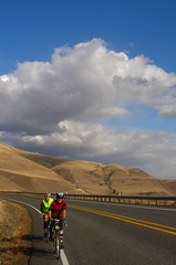
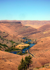
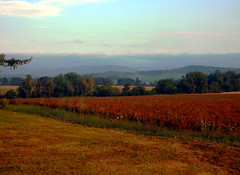
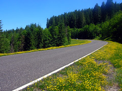
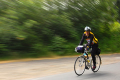
The good news: I finished the Seattle International Randonneurs 600k last weekend (June 13-14). The route started in Auburn, and went through Tacoma, up to the Hood Canal, out to Westport (on the Washington coast), back inland to Morton (via Centralia), up to Enumclaw, and finally back to Auburn. It took me 37 hours and 57 minutes.

On a more dubious note: I have been the last finisher in every 300k or longer brevet I have completed in the last three years. This includes five 300k’s, two 400k’s, and now two 600k’s. (A couple of minor exceptions involve riders on fixies or missed turns due to errors on a cue sheet.)

But in randonneuring, that’s okay. (Or so I’m told.) Finishing is more important than placing high. Results are posted alphabetically. But still, I don’t know anyone who doesn’t pay attention to his or her times, and uses them to gauge their improvement. It can also be good to know how you fare in comparison to others. Some people are so interested, though, they’ll copy and paste the results of any given brevet into Excel and sort by time.

One interesting comparison for me originated from Mark Thomas’s pre-ride report of this 600k. On the difficult XTR 600k a week earlier, he noted his “moving average” was a mere 11.8 mph. But on the SIR 600k, it improved to 14.4 mph. Well guess what, folks. I did the flatter, milder 600k at the same tempo he did the hellishly hot and steep 600k (and he wasn't feeling well, either)!

A little over a year ago, on the Seattle International Randonneurs’ “Three Passes” 400k, I finished with a measly eight minutes to spare. It was then I first heard of Duane Wright. I think it was Peg Winczewski (she and Lesli had their bikes and bags packed and were headin’ out) who commented on my Duane-like finish time, and told me about his reputation for repeatedly completing brevets just under the deadline.

I then heard of Duane a few more times, but didn’t actually meet him until last April at the finish of the Three Capes 300k. He chose to ride his fixed-gear bike on this 185-miler (which I think is insane, and I have two fixies), and admitted to me later how surprised he was to have finished so close to ending time.

For some reason, Duane rode a fixed gear bike on both the SIR 400k (last month in Eastern Washington) and on this 600k. I think he’s pushing the limit. He finished the 400k (but not quite in time), and abandoned the 600k in Cosmopolis (about 237k into the ride). As he put it later, he had a great weekend. It just didn’t involve 600k’s of riding.

It’s not my intention to take up Duane’s mantle. But on the other hand, my motor just isn’t that powerful. I feel like one of those small Honda engines with valves the size of dimes, sharing the road with cyclists equipped with larger bore engines and superchargers. But eh, I finished!

As John Kramer pointed out in a recent blog, the advantage of being faster is that it gives you more options. You can choose to ride slower for the social aspect, or ride faster in order to take longer breaks and naps. He also pointed out that slower riders often ride alone. I can vouch for that. (Fortunately, I seem to have a high tolerance for “aloneness.”)

I certainly like having options in other areas of my life, so it would probably be good to build up a little more speed so I can introduce options to my cycling life as well.

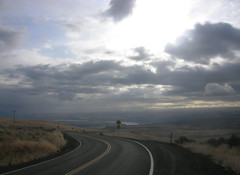
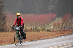
As for the SIR 600k itself, the ride was pleasant weather-wise and control-wise. My plan was to take it easy on day one way to insure I had enough gas for day two.

Duane
Originally uploaded by tangobiker
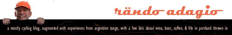
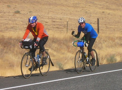
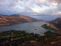
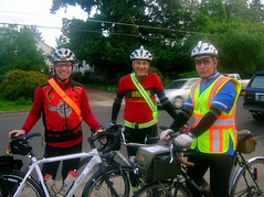
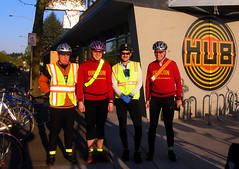
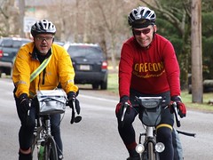
I rode some with Narayan through Tacoma, enjoyed Amy’s cheeriness (and coffee) at the control in Ruston, then eventually caught up with Duane somewhere near Yukon Harbor. We proceeded to hopscotch to Waterman Point, where Eric Vigoren worked the control, and then onwards through Port Orchard and beyond. By the time I got to Belfair, though, I would not see Duane for another 30 hours. And I wouldn’t see another 600k rider till Centralia.

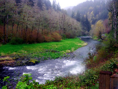
My main problem with this brevet was stopping too often, and too long. But my body seemed to demand a lot of intermittent rest. In retrospect, I could have taken less time in Union (at the SE end of the Hood Canal) and again in Matlock. But in Matlock I was craving an ice cream float, and managed to construct one in my mouth with Coca Cola and an ice cream bar.

I rode in the drops quite a bit from Matlock to Brady, as my hands were becoming increasingly uncomfortable with the hoods and other upper handlebar positions. I just wished my drops were a little less dropped (more like on my LeMond).

After checking in at the Chevron station in Cosmopolis, there was visceral evidence in Aberdeen of how hard the economy’s been hit. An entire shopping mall, complete with a Sears, JC Penneys, and a cinema complex was totally vacant. Not good on a late Saturday afternoon.

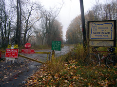
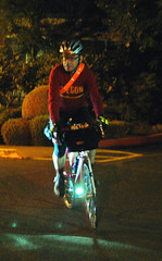
Westport (as the name would suggest) was the western-most point on the journey … hence a control at the local Shell station. As usual, I took too much time figuring out what I wanted/needed. But since daylight was now used up, I didn’t hurry up. Continuing on to Raymond, I could often hear the ocean. But the only things that could be seen were those that were either self-or-E6-luminated.


4:40 AM control
Originally uploaded by tangobiker
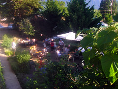
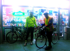
‘Twas a little difficult to figure out the Rainbow Falls State Park control at 4:30 in the morning. Around the point where my computer indicated it could be, there was a blinky light with a little “SIR” sign. Upon closer inspection, I noticed an arrow on the sign pointing onwards. But it didn’t indicate just how far onwards. I figured it was late enough that the control might have packed up, and the sign indicated to go on to Centralia. But low and behold, a few miles later, there was John, Shiela, and Paul camped out alongside the road, with boatloads of food, and a ton of encouragement.

The sun rose between Rainbow Falls and Centralia. Some of the roads around Chehalis were familiar from the Dart I rode with Cecil and Andrew 15 months earlier. But I didn’t have a lot of gas on the last leg before the “overnight” [ha ha] control.

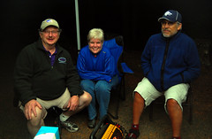
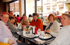
Peter Beeson was a particularly enthusiastic “concierge” at the Centralia control, and his crew most helpful. They woke me up after about an hour nap and fixed me an ample burrito before sending me on my way. One of the crew members suggested I had plenty of time to arrive back in Auburn in good Duane-like fashion. Hmmm.

A couple people warned me (Eric V. being one of them) that the stretch from Centralia to Morton wasn’t as easy as the pre-ride reports suggested. That’s probably true, as my cardiovascular system got some good workouts along that stretch. I also ended up taking an impromptu brunch about halfway to Morton. Between that and lengthy stops in Morton and Elbe, my off-the-bike time was really building up.

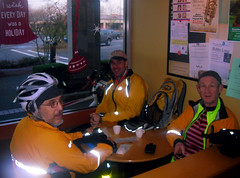
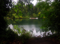
Orville Road between Eatonville and Pioneer Way E (to Buckley) was pretty if not a bit rough (as in coarse pavement). It hugged a couple of serene lakes (Ohop and Kapowsin), although I can’t say the drivers in that area of Pierce County are as serene (particularly the youngsters in pickup trucks). It felt a little like redneck country.

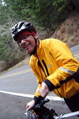
Upon leaving Enumclaw, I noticed that I’d break 38 hours if I hurried. So I hurried. I actually pushed it pretty hard for the last 18 miles, enough that I felt it in my left knee the next day. But I beat 38 hours by three minutes. I might have come in a little sooner had I not lost confidence that SE 368th Street was part of the correct way to get to 212th Way (all nice roads between Enumclaw and Auburn). But I was happy that I had enough in me to push at the end. Perhaps it was the little bottle of Ensure that was given to me in Centralia, but that I waited till Enumclaw to drink.


Narayan
Originally uploaded by tangobiker
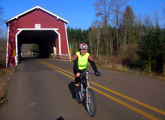
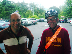
At the motel in Auburn, I ran down the hall to Albert’s room to get checked in, and lo and behold there was Narayan (who had arrived only 25 minutes earlier) and a gentleman from Montana (who was gonna sleep over before driving home). I enjoyed some beer, pizza, and a badly needed shower. But before I started in on a nap of my own (before my drive back to Portland), in comes Duane Wright…in street clothes! I didn’t recognize him at first. He was there to give Narayan a ride home. He was full of good cheer, didn’t seem disappointed about not finishing this particular 600k, and congratulated Narayan and me on our finishes.

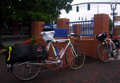
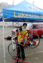
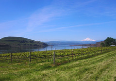
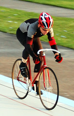
All 17 photos from this ride are here on Flickr.

Friday, June 12, 2009

nocturnal 200k to Dallas (OR) & back


8:00 pm takeoff
Originally uploaded by tangobiker
Not to be confused with the big city in Texas, nor The Dalles (about 80 miles East of Portland on the Columbia River) … Dallas (Oregon) is in Polk County (George Dallas was VP when James Polk was President). The town is about 15 miles west of Salem.

When Marcello Napolitano put out the word he was riding one of his own permanents from Hillsboro to Dallas, I thought this would be a good way to get my R-12 ambitions out of the way early in the month of June. Ray Ogilve must have though so, too, as it was the three of us that took off at 8:10 PM from Marcello’s home in Hillsboro.

It was still light during our first contrôlée in Forest Grove, but then gradually darkened as we headed South on Spring Hill Road. North Valley, Ribbon Ridge, and Kuehne Roads were all familiar, even after dark in the opposite direction than we usually ride them. But then, we blew by Abbey Road and took what amounted to a six-mile detour to Carlton. A local constable suggested to Ray that the quickest way to Layfayette was to return a mile or so back to Mineral Springs Road, which we did.

After a little fueling at a convenience store contrôlée in Dayton, we rode the familiar route through Amity and then Perrydale Road to Dallas.

1:57 AM
Originally uploaded by tangobiker
Usually in Dallas I stop at the Starbucks inside Safeway, which is situated on the East end of town. But as this was my first time in Dallas after dark (or more accurately after business hours), I got my first tour of “downtown” Dallas, complete with two one-way streets and an impressive looking (at least at night) county court building. Marcello knew that the only business open in Dallas after 1:00 AM was a convenience store at the West end of town, and it is there that the three of us re-fueled.

We debated returning via McMinneville rather than Dayton, because we knew there’d be a least once 24-hour market (or a Shari’s) open. But we elected instead to return via the original route, confident we had enough fuel to make it back to Forest Grove. An ATM in Dayton sufficed for the contrôlée there, and birds started to announce that it would be getting light in the next hour or so.

Past Lafayette, the transition from Abbey Road to Kuehne Road is not a problem in the Northbound direction (kind of like a funnel). We negotiated the left turns onto Ribbon Ridge and North Valley Roads without a hitch, but I started falling off the pace a bit on Spring Valley Road. That section sure was purdy during those early AM hours, but I was too anxious to get a caffeine fix in Forest Grove to stop for any pictures.

‘Round 6:30 AM, we stopped at the McDonalds in Forest Grove, where I tried my first espresso drink (a mocha) from that establishment (my most expensive purchase of the trip). Ray got some milk, and Marcello waited patiently for the two of us before our last 9-mile jaunt to Hillsboro.


chicken in the house
Originally uploaded by tangobiker
Ah, the lovely smell of bacon! Ray says he normally can’t eat right after a long ride, but the breakfast that Marcello’s wife Cathy had waiting for us at the finish must have changed his whole body chemistry. ‘Twas a great ending to an 11-hour 30-minute nocturnal 210k. It even included a show-and-tell of the Napolitano’s four chickens by daughter Anna.

The rest of my pictures from the ride are here on Flickr.

Friday, May 22, 2009

intermittent forgetfulness

Saturday, May 16 was a lovely day for a bike ride. I heard it got hot back in Portland. But the hills of central southern Washington were pleasantly warm and welcoming. This is the part of the country through which John Kramer’s “Bingen–Goldendale–Trout Lake” 200k permanent traverses.

On all other permanents I’ve ridden (9 in all) I’ve never forgotten to bring a cue sheet. But this time, it never occurred to me at any point during preparations to print or bring one along. I didn’t even realize the omission until pedaling out of Bingen. Fortunately, the route was the same as the one used for the Bingen Bikenfest brevet in October 2007. Unfortunately, I forgot one fairly important turn.


vineyard on the columbia
Originally uploaded by tangobiker
It’s always interesting the things one remembers and the things one doesn’t. In the morning, I forgot where my wallet was, which made me late to the start. On the ride, I remembered the route out the Gorge (on the Washington side) past The Dalles and on over to Hwy. 97, then up to Goldendale. The Subway/convenience store in Goldendale is a close second in familiarity right after the Thriftway in Newberg.


improv cue sheet
Originally uploaded by tangobiker
John Kramer kindly wrote out a cue sheet on the back of an XTR business card, which worked fine all the way to Glenwood. The 5-mile descent down to the Klickitat River (before Glenwood) brought back memories of the October ’07 brevet (reinforced by this lovely video). I sang Bach melodies all the way down.

But upon leaving Glenwood, I had no memory of which road took me to Trout Lake. It certainly wasn’t the path of least resistance (the only road with a center line). That road is a more direct way back to White Salmon and Bingen, and intersects Hwy 141 at BZ Corners. This mistake caused a rather stressful 11-mile jaunt up Hwy 141 to the contrôle in Trout Lake, and maximum use of all the allotted time.

Interestingly, I didn’t come across another bicyclist all day. Perhaps many were “reaching the beach.” But I was more interested in keeping my goal of a second R-12 intact.

Many thanks to John Kramer for accommodating my relative spontaneity … and um … forgetfulness. ‘Twas a lovely ride.

The rest of my photos are here on Flickr.

Monday, May 18, 2009

personal best … by 4/100 of a second

A “flying 200” (meters) at the Alpenrose Velodrome is used to seed cyclists who race in “sprints” on Fast Twitch Fridays. The flying part relates to the two laps you're given (over 500m) to get up to speed, so that you hit the timing/start line full on. (200 meters is about ¾ of a lap at Alpenrose.)

front straight
Originally uploaded by tangobiker

The hot-rodders (the real athletes) do this distance between 12 and 14 seconds. The record, I believe, is 11:34. My best time last year was a meandering 14:93. It took me all year to get there, as I was usually in the 15's.

Last Friday was my first “Fast Twitch Friday” of 2009, and my flying 200 time was 14:89. While still not fast, it nevertheless feels like an accomplishment.


Thursday, April 30, 2009

not-for-credit flèche

or … my 2nd bike ride to the coast in two weeks!


The "Spokespersons"
Originally uploaded by tangobiker
If someone would have asked if I was interested in doing a circuitous 225-mile 24-hour bicycle ride to the coast and back, featuring some nocturnal riding on cool roads in Clackamas County, an excellent lunch at a Pacific City brewpub, and a beautiful and long (and challenging) riverside road back to wine country, I would have said, “yes!”

But the question that was asked was “Are you interested in doing a flèche?” Or more precisely, “Are you interested in joining a flèche team? … something that includes a bit of elevation gain but a moderate pace … thinking 375-420 kms, keeping stops brief (30 mins or less and infrequent).” To which, I answered … “yes!”

The main differences between the two are 1) a flèche has time constraints, and 2) you’re expected to meet those time constraints with you compatriots. Or as Susan France put it last Sunday, when you’ve given up on the flèche, but still riding, it’s called touring.

Joshua Bryant designed a lovely route with lotsa backroads with minimal traffic. The team was good, too. Ray Ogilvie and RB Buschman are veterans of other flèches. Joshua is a strong yet easy-going rider. I was the slow one of the group, and was happy there were four of us, just in case I didn’t maintain the required pace.

The ride started at the Hopworks Urban Brewery in SE Portland at 7:00 Friday evening (April 24), and headed out Woodstock and Foster Roads to the Springwater Corridor. It got dark at about the 30 km point in Boring. Between there and Silverton, we enjoyed star-filled rural skies and some challenging hills.

Silverton was where the ride went awry. Right away it was a challenge to find a business that was open at 1:00 am that wasn’t a bar. It’s even bleaker at that time of night than Independence. (I know, cuz two years ago a curious policeman in Independence signed Ken Mattina’s and my brevet cards at the same hour.) While I put in an extra mile in Silverton looking for an ATM, Joshua, RB, and Ray entertained (or were entertained by) the local inebriated rowdies. And then while Joshua changed batteries on his taillight and I put on my gloves, RB and Ray took off. It was the last time Joshua and I were to see them for the next 32 hours.

The route out of Silverton is obvious (so I’m told) if you’re familiar with that town. But Joshua and I stayed on Hwy 213 too long, while RB and Ray did something else. Consensus was everyone made wrong turns. But as RB pointed out last Sunday morning, it only takes 50 feet and a turn to lose someone.

With help from Joshua’s iPhone mapping function, he and I got back on track a few miles out of Silverton, and after some deliberation, continued on to Salem. The problem with Salem is that there are many all night businesses that can serve as checkpoints. We chose an AM-PM market on Market St … waited an hour … exchanged cell phone numbers (the obvious omission between the four of us six hours earlier) … then split up looking for RB and Ray. By the time we finally left Salem, we were well behind schedule.

In the meantime, Ray and RB had continued to McMinnville. Of course, I would not learn this until eight hours later. The hardest part of the entire flèche was not knowing where RB and Ray were … for nine full hours. When Ray finally called me (I was on Little Nestucca Road approaching Pacific City), my heart sank to learn that he and RB had abandoned in McMinnville after waiting for Joshua and me for nearly two hours. After all, they had waited well beyond the printed closing time.

It was well into daylight by the time Joshua and I arrived in McMinneville. After Willamina, Joshua went on ahead to try to reel in Ray and RB. When I got Ray’s phone call, I in turn called Joshua. By the time I got to Pacific City, Joshua was already considering alternate plans.

Joshua’s wife Britt offered to drive out to the coast and pick us up, but Joshua and I really wanted to ride Nestucca River Road between Beaver and Carlton. Neither of us had ever been on that road; it was one of the main attractions of the flèche route. On the other hand, we were already familiar with the roads from Carlton to the Forest Grove. So Britt planned to pick us up in Carlton eight hours later.

This allowed Joshua and me to enjoy a relaxed meal at the Pelican Brewery in Pacific City before heading back out over the Coast Range. One beer sampler later, the significant disappointment of getting separated from Ray and RB, and in not finishing the flèche, washed away. The tour was still on!


Nestucca River
Originally uploaded by tangobiker
I had little preconception of Nestucca River Road, expect that it might be similar to Little Nestucca River Road. Boy was I wrong! The summit over the range is much higher on Nestucca River Road, and the approach is relentless. It’s also full of illusions and false summits. There were many times that the only way I knew we hadn’t arrived at top was to watch the river flow continuously toward us. Visually lovely, but physically challenging, the road included a 2 ½-mile rocky dirt/gravel section, and also a couple of steep sections that begged us to dismount and walk.

I spent so much energy pedaling up along the Nestucca River, my legs had little gas for the descent into Carlton. By the time we arrived (about ½ hour later than forecasted), Britt was waiting for us … in front of a closed Ken Wright Cellars. I was grateful for the fig newtons she brought along; they ended up being my dinner, as I wasted no time falling asleep once I got home.


riders and ORRando folk
Originally uploaded by tangobiker
Part of the flèche tradition is for all the teams to have breakfast together the following morning. Since we were the only team this year, breakfast got moved from Forest Grove to downtown Portland. Felt good to ride to Kenny and Zukes on Sunday morning, where Michael Rasmussen and Susan France treated us to a pastrami hash (at least that’s what I had), and a re-hashing the previous day’s events.

‘Twas a good, difficult, and memorable ride, or tour. Next time, cell phone numbers all around!

photos of the fleche-attempt / tour are here on Flickr.

Thursday, April 16, 2009

annual trip to the coast

Don't think I've been to the Oregon coast in the last 3-4 years, except by bicycle. Each time, it's been on a 300 kilometer bike ride from Forest Grove out to Tillamook and Pacific City, then inland to Grand Ronde, Sheridan, Amity and Lafayette, and then back North to Forest Grove. This ride happens every Spring, and is put on by the Oregon Randonneurs. It’s called the Three Capes 300k Brevet.

This year's version (held last Saturday, April 11) was hosted by cycling veterans Cecil-Anne and Lynne, and started promptly at 6:00 AM. I, however, was not prompt. I am definitely NOT an early morning person, and my day job (ironically) involves getting up every weekday before dawn. So by the time weekends roll around, I'm usually ready to ride again sometime ‘round the middle of Saturday afternoon.

On this particular Saturday, I managed to leave home at 5:30 in the morning, and got to Forest Grove 45 minutes later. By 6:30, I was off and rolling on what promised to be another solo rando ride.

On the out-and-back up Timber Road, there were still a dozen riders returning the other way. Many of them were more than 1/2 hour ahead at this point, so I wasn't gaining much ground on anyone. Had a nice short chat with Cecil at the 1st controle, then continued on Hwy 6 towards the coast.

It's interesting the things I remember from previous years’ versions of this ride, and the things I don’t. For instance, I hadn't memorized the topography (or grades). The summit on Hwy 6 came sooner than I expected. And the tough hills between Tillamook and Pacific City seemed less severe than I remembered (although I'll probably never ride them quickly, or on a fixie).

Upon arrival at the Tillamook Safeway, I noticed two bikes, and then their riders (Brad Reber and Ed Groth), who were doing lunch in front of the market. They resumed their ride shortly after I got checked in. We met up again after Netarts, and rode together for much of the way from there … up Little Nestucca River Road, over Summit Sourgrass, and then to Grand Ronde.

I bought some liquids in Grand Ronde and soon pushed on towards Sheridan and beyond while Ed and Brad elected to have a sit down meal from the market’s deli. Nineteen miles later (at the info control in Ballston), Brad passed me. He was quite determined to get to Forest Grove in time to ride to Hillsboro and catch the last Tri-met train to Portland.

Like last year, darkness fell somewhere around Amity. I ran into Brad one last time at one of the small-town convenience stores; he was surprised that Ed hadn’t caught up with me.

I actually felt pretty strong for the remainder of the ride … up Ribbon Ridge, North Valley, Spring Hill, and Fern Hill roads. My lights and reflective material must have worked well, as most of the passing cars gave me about 10 feet of space.

A little before midnight, as Cecil signed my card in Forest Grove, Lynne announced, “It must be Bill,” and promptly fell back to sleep. After a few snacks and refreshments, Cecil expressed some concern about two riders still out on the course … with no cell phones. She contemplated driving the course in reverse when the ride officially ended at 2:00 AM, but I saved her the trouble by driving out there well before then. As it turns out, it was unnecessary. Duane Wright (who I hadn’t seen during the whole ride) and Ed (both of them on fixies!) finished in time. However, it was too late for Ed to catch the Max back from Hillsboro to Portland, so I gave him and his bike a lift back to Portland.

Cape Mears, Cape Lookout, and Cape Kiwanda are the Three Capes featured in this annual bike ride. I didn’t take as many pictures of the coast as last year, because 1) the skies we more overcast, and 2) the visibility less. However, the pictures I did take this year are here on Flickr. (You’ll notice quite a few are of Brad and Ed.)

Tuesday, March 31, 2009

fast guys host a wet one

(124 miles … in constant rain … from Forest Grove to Vernonia and Birkenfield, then back)

The picture I wish I’d taken during the Berkie 200k brevet (but didn’t) is one of Sam, Del, and Mike at the Vernonia control. I mean, how often do NW randonneurs get to see these guys all in one place in street clothes?

Another fast guy, Seattle’s Brian Ohlemeier, did the SIR Spring 200k the previous week (March 21) in 7 hours and 25 minutes. He comes to mind cuz he’s also done hosting duties. In fact, he waited patiently in a hotel in North Bend, WA last May for me to finish a 400k in 26:52, just 8 minutes under the limit.

Okay, I’m a little obsessed with fast guys (particularly, for some reason, the ones who do their share of volunteering) … but I’ll get over it. It’s just that I have no idea what it would be like to live in the body of one of these riders, and to be able to do 200k in, lets say, under 8 hours.

As far as last Saturday’s Birkie brevet was concerned, I had a hard time getting up for it. I had already done a 200k earlier in the month, and felt like I desperately needed some down time. But on the other hand, my March mileage was down. So I told myself that if I could get to sleep uncharacteristically early the night before, I’d make a go of it. After all, my new jacket almost makes me look forward to riding in the rain.

I got up at 4:10 on Saturday morning, left my place at 4:50, and rode the 3 miles Goose Hollow. The first Max train of the day arrived there at 5:20, and deposited me in Hillboro 45 minutes later. After five more miles of riding (it’s really dark between Hillsboro and Cornelius), I arrived in Forest Grove with 15-20 minutes to spare … just enough time to check in, pay some dues, eat a muffin, and douse it with coffee.

Once the ride commenced, I managed to miss just about every signal on Pacific Ave. But once on Gales Creek Road, I ended up tagging along with Peg, Lesli, and Sara. On Timber Road, I was passed by a few riders who must have started later (including RB). And by the time I was heading back on Keasey Road (from the info control), there were still a dozen riders behind me. Most of them caught up in Birkenfield while I washed down a pbj sandwich with a house mocha.


Country Store
Originally uploaded by tangobiker


But it was back at about the 50-mile point (16 miles before Birkenfield) where I started having serious misgivings about this ride. I felt finished. Perhaps undernourished. I wanted to be anywhere BUT where I was (pedaling along Highway 47) … somewhere that involved lying horizontally … home … the acupuncturist’s … anywhere. Despite a brief respite at the Birkenfield Country Store, this feeling persisted all the way back to Vernonia (mile 88). Odd, because riding along beautiful riverside roads is one of my favorite things to do (even when it’s wet). But my body didn’t care. It wanted out.

I made quick work of the return Vernonia control … visited an ATM and public restroom, and downed a GU energy gel. Surprisingly restorative.

And lucky for me, I met up with Greg Olson for the last 36 miles. Greg is a fast rider who started 40 minutes late (which is often his habit). Later on, his tire pump broke as he was repairing a flat, and he had to wait 40 additional minutes for a rider to come along. With this 80-minute handicap, we ended up leaving Vernonia at the same time.

Greg seemed quite content to pedal at my 12 mph pace for the remainder of the ride. He was chatty and had lotsa stories, all which had an energizing effect on me. Of course, maybe it did have something to do with his not wanting to be stranded without a pump again.

At Glenwood, I had a craving for a corn dog, but the closest thing the Shell station had was a $1 BBQ burrito. It hit the spot, and gave me gumption for the final 12 miles back to Forest Grove … (helped by a nice tailwind!).

Upon arrival at the McMenammin’s lodge, I didn’t look at my watch, nor check the time that Sam wrote on my brevet card. But according to time stamp on a picture of Greg checking in, it looks like we finished in 11 hours and 22 minutes. It felt slower, and harder than that. ‘Twas about an hour more than my time two years ago, and 15 minutes more than last year. Doesn’t look like I’m getting any quicker.

I didn’t stick around the finish too long, as Brad Reher and Ed Groth (the latter of whom did the entire ride on a fixie) were departing to Hillsboro. I tagged along. Five miles later, the three of us found Adam George already waiting for the Max.

I’ve been on rides before where I didn’t know if I’d be able to finish … but I don’t remember one where I experienced such second thoughts in the middle of the ride about doing it at all ... even during the 600k last Fall. But it all seemed to significantly wash away once I soaked in the tub at home afterwards.

Michael Johnson's report
Cecil's report
Lesli's pictures
my pictures

Monday, March 23, 2009

SIR Spring "Chili Feed" 200k


Initially, I did not plan to ride the SIR Spring “Chili Feed” 200k, as I have so little down time any more. But when Joshua Bryant posted a request for a ride to Kent on the Saturday morning of the brevet, I decided otherwise. After all, even though the ride was real tough for me last year (seat and knee problems), I had fond memories of the carpooling and “chili feed” parts.

Joshua met me at my place in SE Portland at 3:00 AM. After some French toast and tea, we loaded his bike and were heading north on I-5 by 3:30.

We would have gotten to Kent in plenty of time except for an ill-timed restroom/coffee stop somewhere between Olympia and Lacey. The only open business was a Sheri’s restaurant, selling rot-gut coffee for over $2/cup. We also had a hard time finding our way back to I-5 north, but with the eventual help of a convenience store clerk, finally righted our course.

We pulled in behind a long line of parked cars in Greg Cox’s neighborhood, and immediately set off on getting dressed and registered. I stopped a little too long to admire TRFKAF’s (Cecil’s stuffed rabbit’s) new Shower’s Pass rain vest, and ended up starting about 4 minutes after everyone else. Nevertheless, I caught up with a number of people fairly soon, and had company all the way to the first control in Dash Point.

Eric Vigoren caught up with me somewhere around Auburn , and we hopscotched a bit to Black Diamond. It was fun for me to learn more about Eric … not only that he’s working on an R-40-something … but also about his non-cycling (UW) exploits.

I brought along a couple of peanut butter jelly sandwiches, so I wasn’t into the bakery thing in Black Diamond. However, I am into espresso machiattos (my favorite control beverage), but that drink wasn’t in the barista’s repertoire. Her approximation was pleasant enough, though.

P3211185
Originally uploaded by Seattle Randonneur

If not speedily, I at least rode steadily up to Greenwater, a big improvement over last year. A bike fitting and a few orthodics later, last year's knee pains thankfully stayed away for the most part. I tried to take pictures of a lot of the riders returning down Hwy 410, but my camera wasn’t behaving well. The old point-&-shoot Coolpix rebelled against my shoot-&-hope tactics.

My less-than-a-full-night’s-sleep the night before caught up with me in Greenwater. There were about 18 bicycles parked there when I arrived, and none when I finally left. But I really needed to sit down with my 2nd pbj sandwich, which was accompanied by a V8 fruit juice concoction. I was hoping for something a little more nourishing, but the inventory of that general store caters more to motorcyclists' diets rather than bicyclists'.

There were still a dozen or so cyclists heading up to Greenwater during my descent. A little before Mud Mountain Dam Road , I starting leap-frogging with Paul Whitney and another gentleman (whose name escapes me now) all the way to Enumclaw. Since this was my 2nd time on this brevet, I was able to navigate to the Circle K control much more efficiently this time ‘round. I arrived at 4:20 PM, and decided to make quick work of Enumclaw, and try to make it back to the finish in under 11 hours (which made the last 20 miles a bit of a push). One hour, 35 minutes, and one rainstorm later, I succeeded.

As I approached the Cox’s home, I noticed Joshua’s bicycle already mounted on the back of my car. What I didn’t know was that he was napping inside the back. He had already had his fill of chili and veggies.

My final time of 10:55 was 2 hours and 3 minutes better than last year’s painful 12:58. Other benefits of coming in sooner were 1) I had daylight all the way!, and 2) the party at the Cox’s was a lot more active than when I arrived last year. Not only that, it was still daylight during the drive down I-5 almost all the way to Centralia!

Things that worked well this ride:

  • Bolted on fenders! Since my bike has doubled as a cyclocross bike, I cycled all of last year with rubber-banded (easily detached) fenders, which were prone to rattle quite noisily. Ah, blessed silence!
  • Wardrobe: My new Showers Pass jacket (the most expensive article of clothing I own) in combination with my first ever wool jersey (newly acquired Woolistic “Oregon Randonneurs” model) were quite comfortable and effective.

Thing that doesn't work well:

  • My bike still shimmies when I let off the handlebars. It seemed more pronounced on this ride, as I was carrying less weight in my handlebar bag than usual. I may start experimenting with different forks, as I know my bike is too short and steep for optimal randonneuring.

Many thanks to Greg and Mary Cox and all the SIR volunteers for a wonderful event.

Sunday, March 15, 2009

soggy snooseville

It didn’t start raining … until 5 minutes before the start.

Thirty-eight hearty souls pedaled off from the Cornelius Pass Roadhouse at the designated 8:00 AM time on what was to be a wet and windy two-wheeled ramble through rural Washington County. The attrition rate was high for a ride of this length; only 30 riders finished. The good news, though, is that the other 8 starters were all accounted for by ride’s end. I think a number of them of them just weren’t having fun, probably due to cold feet and hands. The extremities are a challenge to keep warm when it’s windy and wet … even for more experienced long-distance riders.


cDSC_0722
Originally uploaded by tangobiker
Most of the finishers, though, seemed exhilarated at the end. Chatty and relieved, many seemed to have enjoyed the workout. ‘Twas a ride well done by all of them.

Particular kudos go to the volunteers on this ride … Ray, Barbara, and Susan at the Snooseville/Fern Flat Road. turnaround … Joshua at the now not-so-secret control at Strohmayer Road … Gregg in Forest Grove … and Ken & Rose at the finish.

Joshua was my hero of the day, as he bicycled all the way to the secret control (about 8 miles beyond Forest Grove) from his home in SE Portland, and then waited over two hours for the 30 riders to pass through. It’s definitely easier to stay warm when you’re pedaling than it is when you’re working a control without shelter (no car or building nearby). But the spot seemed so perfect a week earlier, a day that was forecasted similarly to the ride date, but ended up so different. Fortunately, I was able to text Joshua when the last four riders turned right onto Mountaindale Road from Dairy Creek, which helped him know when his shift was over. A shift done without carbon footprint.

Gregg’s carbon footprint wasn’t much larger. He drove his SmartCar out to Forest Grove (it’s funny when he straps his recumbent to that thing) and then “set up shop” in front of Maggie’s Buns. This ended up being the most thoroughly photographed control I have ever seen. When Gregg returned to the Cornelius Pass Roadhouse, he showed Susan & me dozens of pictures (from his laptop). I don’t think he missed any riders. Plus he got a few Portland Velo cyclists, and also some ambience from Forest Grove. His pictures are here on Picasa.

One of the nice things about all the volunteer help this year is that it freed me up to take quite a few pictures of my own, which can be viewed here on Flickr.

Thanks to all who came out and participated in this year’s Snooseville Populaire. ‘Twas a pleasure to organize.